
Your land, monitored from space.
InSAR Land Monitoring
LandSure's InSAR Monitoring uses the same satellite data, updated every 12 days - but instead of a one-time report, your property is continuously watched. When the AI detects a change in movement pattern, you get an alert. Before there's anything visible on the ground.
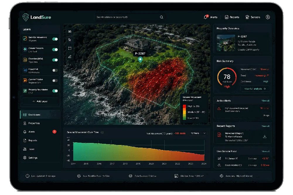
3.2mm acceleration
Please read before you buy. LandSure is not a geotechnical engineer, and this report is not analysis, certification or a professional opinion. Think of it as a canary in the coal mine - a satellite data report that flags where the ground may be moving. It is meant to be used alongside your local geotechnical engineer, who knows your area and the differences in the land. InSAR does not work equally well in all land types, so please check that this product is right for you before purchasing.
Be first on the list.
LandSure Monitoring will be available in Q3 2026. Sign up now and you'll be first to access it - at an introductory rate available only to the waitlist.
You're on the list.
We'll be in touch as we approach launch. In the meantime - start with your 10 Year Land Subsidence Report.