
Know the ground before you buy.
10-year land stability reports you can trust.
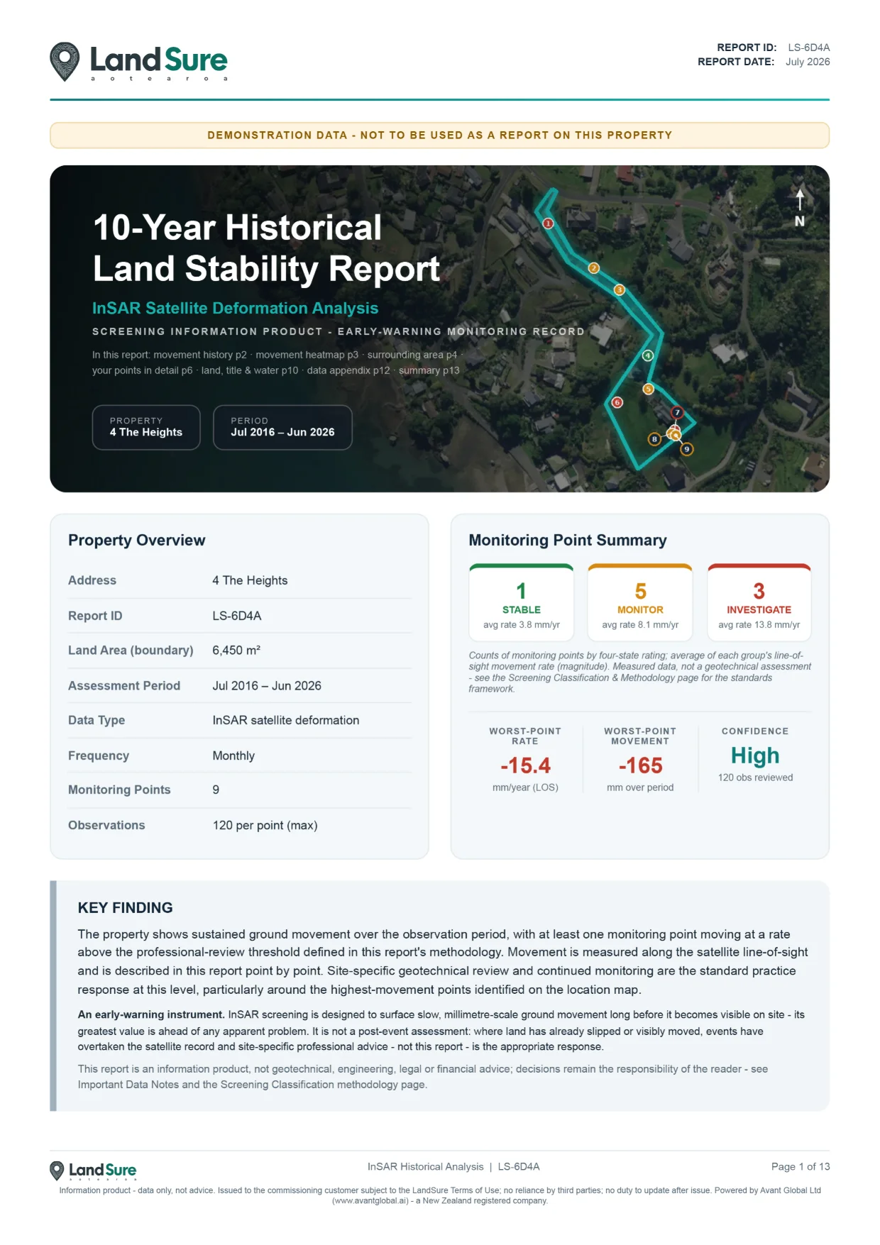
Our 10-year InSAR satellite reports reveal hidden land movement risks so you can buy with confidence and avoid costly surprises.
 NZ Owned & Operated
Enter an address and we'll check land stability and calculate your price.
Checking as ·
Property boundary detected
Your price
Delivered within 24 hours · expert checked
What you’re seeing: your LINZ parcel boundary on satellite imagery, priced by property area. InSAR reads buildings and hard surfaces best — it’s less reliable on bush, water and very fast movement. See “Where LandSure works best” below.
✓ Quote request captured — we'll email it to you.


 NZ Owned & Operated
HOW YOU WILL RECIEVE YOUR REPORT – DELIVERED WITHIN 24 HOURS
1Order placed
You place your order and we confirm your property details instantly.
2Analysing data
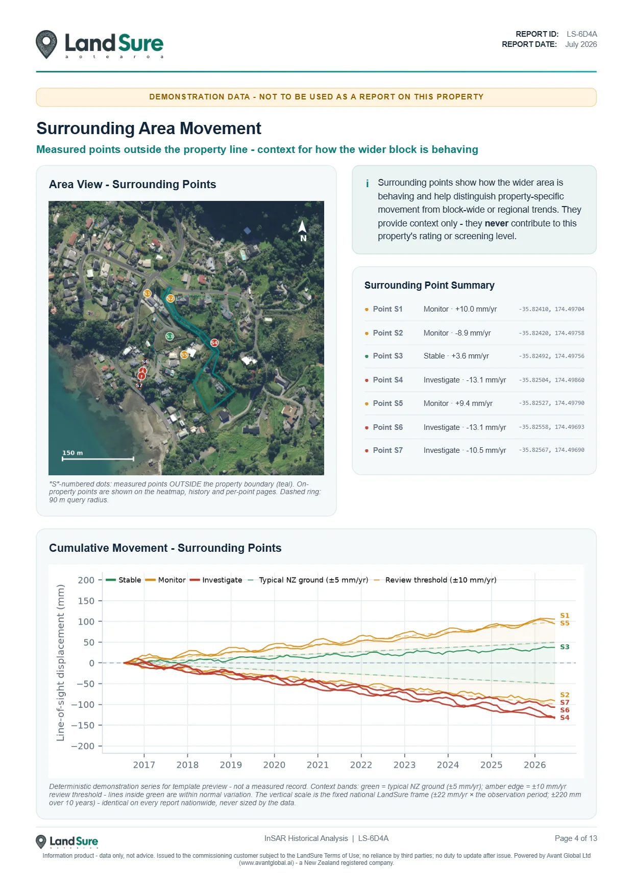
Our InSAR satellites process 10 years of data for your property and surrounds.
3NZ Geotech sign-off
A NZ geotechnical engineer reviews and verifies the data for human sign-off.
4Email delivery
Your completed report is delivered to your inbox within 24 hours.
What unstable ground can cost you
Cracks, tilting and foundation issues can cost $10,000s to fix.
Movement can affect your insurance cover or future claims.
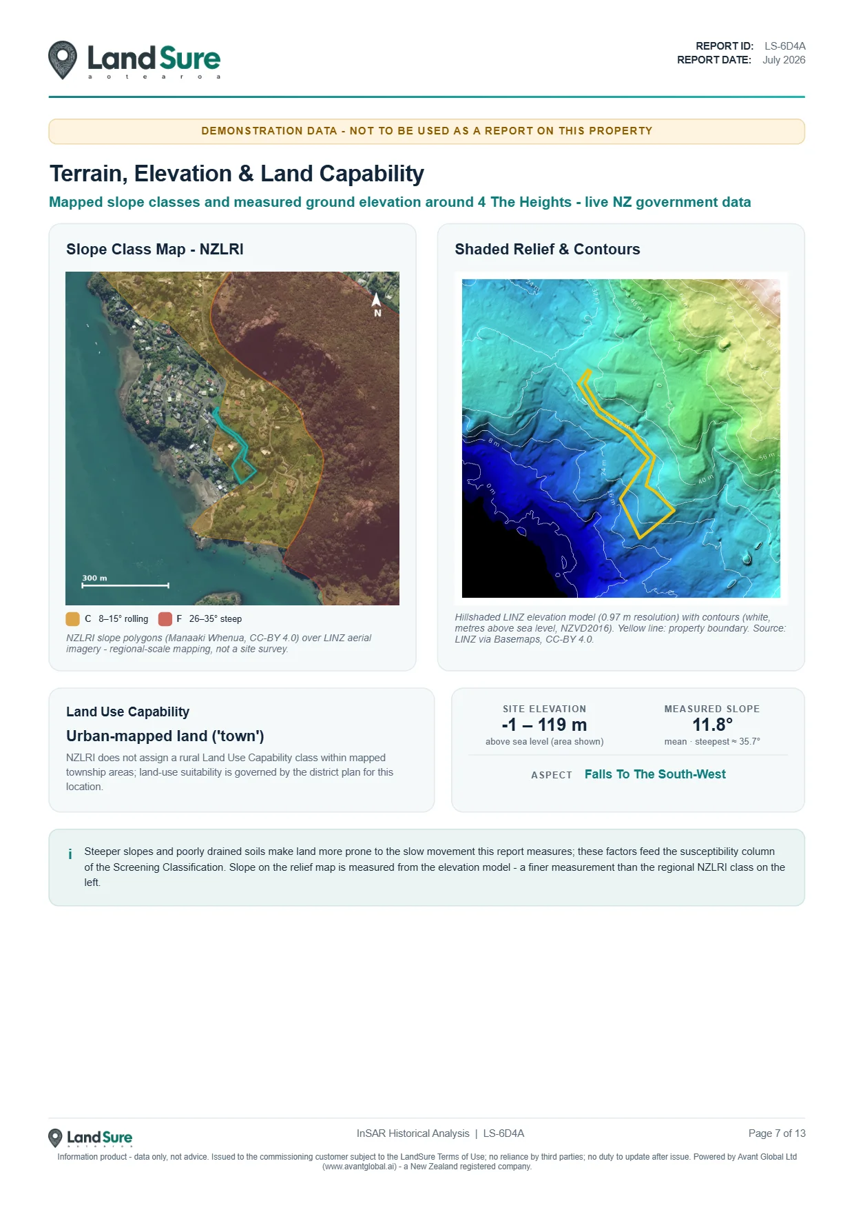
Unstable land can significantly impact what your property is worth.
It's invisible to the eye. Our data shows what you can't see.
Where LandSure works best (and limits)
GREAT FOR
LIMITED RELIABILITY
Please read before you buy. LandSure is not a geotechnical engineer, and this report is not analysis, certification or a professional opinion. Think of it as a canary in the coal mine - a satellite data report that flags where the ground may be moving. It is meant to be used alongside your local geotechnical engineer, who knows your area and the differences in the land. InSAR does not work equally well in all land types, so please check that this product is right for you before purchasing.
Need bulk reports or API access for your business?
We work with geotechnical firms, planners, surveyors, real estate agents and more.
No obligation. Just answers.